Showing posts with label Yucatán Ruins. Show all posts

Thursday, July 9, 2009

Oxkintok Ruinas


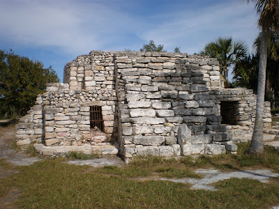
Buildings in Ah Canul Group dating back to 500-600 AD.


(I am unable to move these photos around. They are out of order. I'm going to have to wing it and post the information separately.)

Evidence of two distinct building styles and phases, Ah Canul Group.


The above photos taken of courtyard in the Ah Canul Group.

The road to ruins.


The grounds were extensive and nicely manicured. It was really peaceful there.


The largest restored pyramid in the Ah May Group.


The labyrinth.


Monday, May 18, 2009

Labná

Labná, or "Casa Vieja" in Mayan, is located 122 kms. south of Mérida along Hwy 261, or more commonly known as LA RUTA PUUC. "Puuc" means "hilly" or "hills", thus also describes the typical architecture found in this area. Several ruins are located in the vicinity which might be the only part of Yucatán state that is not as flat as a cornfield in Iowa.
Labná is treated as a lesser known ruin because only an area of 300 square meters is open to visitors. Its numerous buildings are spread out over a much larger unrestored, undiscovered area. It is believed at least 3000 Maya lived here between the years 600-900 AD.
The main structures are connected by a series of sacb'e(o'ob) (white roads), the longest of which is shown in the photo below.

Labná is a great day trip from Mérida. We got off to a late start the day we went and didn't stop at other Puuc ruins that day. When we got there we were the only visitors on the site. The temples and buildings are set in an open flat area that is nestled in the Puuc. Other than the manicured lawn, the area is lush with vegetation and birdlife. The caretakers of the area are very laid back, and we took the opportunity to practice some of our Mayan language skills with them. They sell cold drinks and memorabilia and talk story with the visitors.

The first thing you see entering the site is the Palacio. It is one of the longest buildings in the region, very decoratively carved and quite well preserved. There are many impressive and unique carvings, including several of Chak, the rain god.
Contemplating the Palacio is Lynne, visiting from Alaska. This was the first Mayan ruin site she had ever visited.


Looking down the length of the main section of El Palacio.


This is the kind of place I can sit and think for hours about what all this means. A visit to Labná makes for an inspiring location to write or draw.

Chak mask.

Looking at El Palacio from afar. The lawn is inviting, isn't it?
This is a reconstruction of Labná's most famous feature, the corbeled arch, connected to the Palacio by a long sacbé. This scan from the book "El Mundo Maya Reconstruido" written by...as far as I can tell, several contributors. It shows the arch as it was thought to have been a link between two enclosed courtyards.

Today the arch stands alone and connects two separate open plazas.

The Puuc architecture is known for its corbeled arches. The one below is part of the Palacio and we were in awe of its construction.

The longest sacbé here begins at the Palacio and leads to el Mirador, a pyramid topped by a temple topped by a Petén style facade. The pyramid is mostly rubble and cannot be climbed. The temple at the top is positioned to be a lookout, hence the name, El Mirador. It's a good example of the Maya building over sites, adding to sites, and the changes that occurred throughout their time.

Next time I head down the Ruta Puuc, I'll get an earlier start so we can stop at Uxmal, Kabah, Sayil and Xlapak, all nearby. All in due time, folks. We'll visit them all.

Tuesday, March 24, 2009

Dzibilchaltún Revisited


The Temple of the Seven Dolls or La Casa de las Siete Muñecas is named for the seven figurines found here during its excavation. The platform or base of this temple is one of the oldest known conserved structures in the Yucatán. The roofs and walls of this and the other pre-classic buildings on site were made of uncut rocks, with a clay or mud mortar. Post-classic constructions, as evidenced in the temple on top, were cut rocks held together with a lime based cement.


This is the doorway that we were looking into on the morning of the equinox. There is another room inside the area I am standing in. All the doors and windows are aligned to face cardinal points and their orientation coincides with light and shade associated with solstices and equinoxes.

The first set of ruins you see behind me is part of the Group of the Seven Dolls. On the morning of the equinox the sun shone through the door and lit up a perfect golden square against its wall.

Another great aspect of the above photo is the view of a typical sacbé, or causeway, found at most Mayan ruins. Some of these causeways connect the cities themselves and have existed for centuries. There are usually causeways within the cities and ceremonial centers also.


It is believed that the Temple of the Seven Dolls was never used as a residence, but instead artisans worked inside creating among other things offerings required for rituals

Tuesday, December 9, 2008

Xcambo

La cienega, or marshland, on the side of the road to Xcambo.


View of the Temple of the Cross, the ball court, chapel and guest booth.

Friday, December 5, 2008, Pablo and I felt like hiking around some ruins AND heading seaside for some fresh mariscos. Neither of us had been to Xcambo, and it is only 63 km. away. Although Tulum is said to be the only seaside Mayan ruin, Xcambo is only two kilometers from the Gulf Coast, and conveniently located for our half day excursion.

From Mérida we drove toward Progreso and followed the coast road east toward Telchac Puerto. After 20 kilometers, more or less, we saw the turnoff for Xcambo. The road is paved and in good condition. To our left were salt flats and on the right was marshland where bright pink flamingos, white storks, and gray herons were feeding in the reddened water. The ruin site was a pleasant surprise. There was a caretaker in a palapa monitoring the guest register, but there was no entrance fee.

Xcambo is a thought provoking site. The site was only excavated within the past ten years, and is still under reconstruction. The name Xcambo means either “Lugar de la donacella” (Place of virginity/maidenhood) or “Lugar de la luna menguante” (Place of the decreasing or ebbing moon). Its name has been spelled Xcambo and Xtambo. Spelling in Mayan is often inconsistent since it was a spoken language. Its writing was in hieroglyphics. Depending on who did the translating affected the final spelling of many of the places with Mayan names.

This was an important salt and saltfish trading post during Xcambo’s longest period of occupation, from 300 – 600 AD. It is thought 6,000 people lived in the surrounding areas. In 2001, 600 skeletal remains were found at the site. According to archeologists, the skeletons revealed a community relatively free of disease. Also found at Xcambo were several artifacts from Guatemala and Belize, leading experts to believe this was an important trading area.

There are two tall temples sitting at the north and south positions of the acropolis. The view of the shoreline from atop the pyramids is impressive. Along the pathways there are wells, or cenotes, and stones carved into basins. Of note were several circular patterns set in stone on the ground. Most interesting was the half Mayan, half Christian chapel. It was a simple palapa roof over thick blocks of stone. The altar brought pictures to my mind of sacrifices, but they well may be of the “Body of Christ” type rather than “body of enemy”. Most of the site was built of huge square boulders, but there were some eloquent smaller rocks also patterned in, including an inverted V-shaped doorway typically seen on the Ruta Puuc. Of the residential buildings that remained, we noticed the doorways were only a meter tall. We wondered if aluxes inhabited the area.

We sat on top of the tallest pyramid and enjoyed the panoramic view and fresh sea breeze as we listened to the palms and pandanus swaying in the otherwise unbroken silence of Mayan spirits.
Temple of the aluxes? See the little door in the middle?
One of several dry cenotes.


The inverted V archway behind the chapel.

The chapel.

The Virgin of Guadalupe honored at the altar.

The chapel catches your eye as you enter the site.

Small temple next to Temple of the Cross.

Center circle is a cenote full of water. Carved basins hold water in the surrounding rocks.

Lots of these scattered around.

Circular bases also common.

The area was clean and manicured.

Sunday, November 2, 2008

Yaxuná


Mayan woman carries tortillas on her head as she walks past the old church in the Pueblo of Yaxuná.

Yaxuná (Yah-shoo-nah') in Mayan means "The turquoise colored house". The ruins are located twenty kilometers south of Chichén Itzá, Estado de Yucatán. Archeologists have discovered PreClassic era temples from 400 BC underneath the pyramids. The nomadic Mayans who again inhabited the site hundreds of years later built around and on top of the original temples. In the past twenty-five years there has been a lot of exploration of the site. It was found to be an important agricultural site and still is surrounded by corn fields and other crops.


The sacbe here, or raised causeway, is the longest known Mayan road in existence. It extends 100 kilometers leading directly to Coba. Yaxuná's temples were some of the highest and grandest pyramids of their day, built of monolithic stones. There is proof that this was a major area of inhabitation in PreClassic days.


This is probably a PreClassic piece, as the carvings are difficult to decipher.
Several temples had walls of carved stones on the bottom, and the rows of columns on top. My best reference states these are consistent with the Puuc style, similar to Labna, Sayil, Edzná,Uxmal, etc. Most archeologists think these structures were built from 400-650 AD, but this is an unknown that is currently being researched. There are some gray areas in the history of the Maya, and different influences, or styles, have been noted of people from as far away as Honduras, El Salvador, Guatemala, as well as outside the Yucatán, México. I am reading a book about the excavations at Yaxuná but it doesn´t have any photos so I am not sure what is what. It's fun to try to imagine what these places looked like twenty-five hundred years ago or a thousand years ago, but sometimes it is just overwhelming. This is one of the things I like most about visiting all the sites, the chance to sit and try to imagine life in the past.


When we climbed the first pyramid, which you can see is not completely excavated or maintained, we saw a snake slither by. This made us hesitant to stray too far from the beaten path. Had we gone into the brush a little farther we would have found some of the many excavations of recent years. But after crossing the line at Palenque, we decided we were not showing enough respect to the Mayan gods and have altered our ruin exploration behavior.


Many of the heirogyphs have the symbol of the cross, which signifies north, south, east and west to the Maya. This symbol is often seen at the older sites.

This is probably another temple. The area around Yaxuná is flat, so any protrusions like are sites awaiting excavation. The history that is buried in places like this will supply archeologists new and useful information in the near future. Much interest has been sparked in Mayan ruins since they named Chichén Itzá one of the Modern 7 Wonders of the World. According to the Diario del Yucatán newspaper, there are plans to continue work on this site and others that are situated around the area (like Ek Balam, where excavations were begun but not completed).


Some of the early monolithic stones used to construct the early temples.

The ball court at Yaxuná.


One of the tallest pyramids from the PreClassic period in evidence in the Yucatán today.


Rounded Caracol shape building similar to the Chichén Itzá style.


Altar? Sundial?

Thursday, October 23, 2008

Mayapan


We were two of four total visitors to Mayapan one Sunday in June. There was a stillness about the place, and not just because of the lack of wind or stifling heat of summer. Nor was it the absence of huge tour buses and incessantly chattering tourists. It is a place I found peace of mind. I would like to spend more days sitting atop the highest pyramid and writing, while Pablo plays his tambor or sketches the surroundings.

Twelve thousand people are believed to have been living in Mayapán during its flourishing period in the 11th and 12th centuries. There were some 3600 buildings and 20 cenotes at the core of the center surrounded by 8 kms. of rock walls. It has not gone through major restoration, thus some visitors to this site do not see it as impressive, according to guide books I have read. What seemed so interesting to me were the thought provoking, unique rock shapes on the ground, the small wells, and the numerous cenotes.


According to Mayan lore, Mayapán was founded by the man-god Quetzalcoatl (Kukulkán in Maya) in 1007 AD. It was one of the three most important ceremonial and trade centers in the Yucatan during its time. For two and a half centuries it was the capital of a Mayan confederacy of city states with Uxmal and Chichén Itzá. In the 1200's the rulers of Mayapan conquered Chichén and Uxmal and held its leaders captive. A successful revolt of the captive rulers brought down Mayapán and it was all but abandoned in the mid-1400's.

The style of architecture here is very much like that of Chichén, although there are obvious Toltec and Puuc influences. The core of the site is smaller, and perhaps that is why for the first time I could almost envision the daily life of the original inhabitants. Although the grounds left you with the feeling that a lot of warring went on there, beyond that was the presence of all the people who lived there.

One of the advantages in visiting sites like Mayapán is that you can still climb all the pyramids and really explore the site in depth. So many of the heavily visited locations have created security restrictions. The government gets very protective when they are actively finding treasures buried inside the hidden tombs.

This apparent space ship landing lies at the bottom of one of the tallest temples on the site. Seriously, there is a well in the middle and I have to wonder what purpose the surrounding buildings served.This is a glimpse of El Castillo (the tall pyramid on the right) and El Caracol (the round building in the back on the left). This is a smaller version of the sight at Chichén Itzá. The buildings are almost the same.

The painted murals were impressive. These colors have held up for over a thousand years. These are the predominant colors found at most ruins where color murals are found, as the Mayans were traders and shared knowledge, obviously including dyes that were permanent and good for painting stories on the walls.

The ball court is hidden behind the cenote. The trees you see are growing out of the center of the cenote.
"Late post classic Maya society has been characterized as efficient and mercantile. The shift in focus away from elaborate architecture reflects an important reorientation in political and economic organization. Social energies were invested into economic production and exchange, and market systems encouraged participation from all members of society in economic affairs, providing them with the opportunity to profit from the fruits of their labor. This open economic system rewarded entrepreneurs, and decreased social distances between elites and commoners, allowing more people to enjoy an affluent lifestyle. The less elaborate public and residential architecture is viewed, not as a "devolution" of former Classic practices, but a reflection of new social norms and economic priorities..." -MAYA DIVINE KINGS OF THE RAIN FOREST, p.346